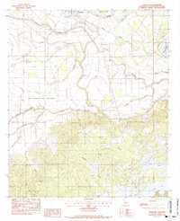
1983 Map of Powhatan
USGS Topo · Published 1984About this map
The town of Powhatan sits along the Old River in the Natchitoches Parish, surrounded by a complex network of bayous and sloughs that define the regional geography in the early 1980s. The northern reaches are characterized by the Missouri Pacific railroad line and the expansive Old Spanish Lake Lowlands, while the southern half transitions into more varied terrain marked by watercourses like the Rio Hondo and Breedlove Branch.
Find a feature on this map
36 named features on this map. Tap any name to fly to it.
Don’t see what you’re looking for? This feature index may not catch every label — zoom into the map to look around manually.
Map Details
Editions of this 1983 Powhatan Map
3 editions found
Other maps of this area

1935 · Hagewood
USGS Topo · 1:31,680

1937 · Campti NE
USGS Topo · 1:31,680

1937 · Bermuda
USGS Topo · 1:31,680

1937 · Campti SE
USGS Topo · 1:31,680

1937 · Campti NW
USGS Topo · 1:31,680

1937 · Campti SW
USGS Topo · 1:31,680

1938 · Allen
USGS Topo · 1:31,680

1938 · Lake End
USGS Topo · 1:31,680

1942 · Many
USGS Topo · 1:62,500

1943 · Many
USGS Topo · 1:62,500