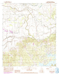
1983 Map of Powhatan
USGS Topo · Published 1992About this map
Powhatan serves as a focal point in this portion of Natchitoches Parish, where the winding course of the Red River and Pierre Bayou shapes the local geography. The landscape is defined by the expansive Old Spanish Lake Lowlands, a terrain of bayous and sloughs that reflect the intricate hydrological history of the region. Transportation and commerce are marked by the Missouri Pacific railroad corridor, which parallels the river valley and links the scattered communities.
Find a feature on this map
35 named features on this map. Tap any name to fly to it.
Don’t see what you’re looking for? This feature index may not catch every label — zoom into the map to look around manually.
Map Details
Editions of this 1983 Powhatan Map
3 editions found
Other maps of this area

1935 · Hagewood
USGS Topo · 1:31,680

1937 · Campti NE
USGS Topo · 1:31,680

1937 · Bermuda
USGS Topo · 1:31,680

1937 · Campti SE
USGS Topo · 1:31,680

1937 · Campti NW
USGS Topo · 1:31,680

1937 · Campti SW
USGS Topo · 1:31,680

1938 · Allen
USGS Topo · 1:31,680

1938 · Lake End
USGS Topo · 1:31,680

1942 · Many
USGS Topo · 1:62,500

1943 · Many
USGS Topo · 1:62,500