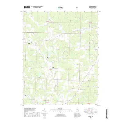
2017 Map of Poynor
USGS Topo · Published 2017About this map
Poynor and the surrounding rural landscape of Ripley County are defined by the winding course of the Fourche River and its numerous tributaries. This survey details the transition from the protected woodlands of the Mark Twain National Forest to the agricultural reaches near Leibig and Ponder. The area's genealogical depth is visible in its many small burial grounds, including the Old Ponder Cem, Patterson Cem, and Murrell Cem, which are scattered among family-named roads like Dalton Rd.
Find a feature on this map
62 named features on this map. Tap any name to fly to it.
Don’t see what you’re looking for? This feature index may not catch every label — zoom into the map to look around manually.
Map Details
Editions of this 2017 Poynor Map
This is the sole edition of this map. No revisions or reprints were ever made.
Other maps of this area

1935 · Reyno
USGS Topo · 1:62,500

1939 · Doniphan
USGS Topo · 1:62,500

1941 · Gatewood
USGS Topo · 1:62,500

1945 · Doniphan
USGS Topo · 1:62,500

1945 · Gatewood
USGS Topo · 1:62,500

1957 · Poplar Bluff
USGS Topo · 1:250,000

1959 · Poplar Bluff
USGS Topo · 1:250,000

1960 · Poplar Bluff
USGS Topo · 1:250,000

1965 · Gatewood
USGS Topo · 1:24,000
1965 · Bardley
USGS Topo · 1:24,000