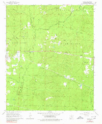
1964 Map of Prague
USGS Topo · Published 1980About this map
Prague stands as the primary settlement in this part of Grant County, situated at a junction near the headwaters of Derrieusseaux Creek. The landscape is defined by an intricate network of drainage, where Hurricane Creek and Hubbard Creek carve through the townships of Merry Green and Darysaw. This 1960s survey captures a rural Arkansas community reliant on a patchwork of small-scale industry and faith, evidenced by numerous Gravel Pits and local congregations like Providence Ch and the Church of Jesus Christ. To the north, Simpson Creek and Mud Creek feed into the broader watershed, while family history is preserved at the Center Campground Cem and Oak Grove Cem. The presence of a Gaging Station on the creek suggests the ongoing importance of water management in this forest-heavy terrain during the mid-20th century.
Find a feature on this map
30 named features on this map. Tap any name to fly to it.
Don’t see what you’re looking for? This feature index may not catch every label — zoom into the map to look around manually.
Map Details
Editions of this 1964 Prague Map
3 editions found
Other maps of this area

1932 · Pastoria
USGS Topo · 1:62,500

1935 · Pastoria
USGS Topo · 1:62,500

1955 · Little Rock
USGS Topo · 1:250,000

1956 · Little Rock
USGS Topo · 1:250,000

1960 · Little Rock
USGS Topo · 1:250,000

1962 · Pine Bluff NW
USGS Topo · 1:24,000

1964 · Little Rock
USGS Topo · 1:250,000

1964 · Sheridan
USGS Topo · 1:24,000

1964 · Cane Creek
USGS Topo · 1:24,000

1964 · Belfast
USGS Topo · 1:24,000