
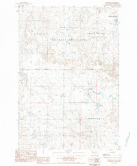
1983 Map of Prairie City NE
USGS Topo · Published 1984About this map
The South Fork Grand River meanders through this portion of Perkins County, shaping a landscape defined by seasonal drainages and high ground. The 1983 field check documents a rural environment where large topographical areas like Wilson, Glendo, and Sidney are identified, possibly reflecting historical school districts or early ranching boundaries. The drainage network is particularly detailed, showing the convergence of Duck Creek and Gooseneck Cr with the river system. Man-made infrastructure is sparse, limited to scattered Well sites and a Gravel Pit, suggesting a region primarily dedicated to rangeland and resource extraction. In the southern reach, White Hill and Vail mark significant terrain features overlooking the Big Nasty Creek valley. This provisional survey captures the quiet, expansive nature of the South Dakota plains before modern developments, preserving the nomenclature of a bygone ranching era.
Find a feature on this map
12 named features on this map. Tap any name to fly to it.
Don’t see what you’re looking for? This feature index may not catch every label — zoom into the map to look around manually.
Map Details
Editions of this 1983 Prairie City NE Map
This is the sole edition of this map. No revisions or reprints were ever made.
Other maps of this area

1954 · Lemmon
USGS Topo · 1:250,000

1957 · Lemmon
USGS Topo · 1:250,000

1983 · Grandmas Butte
USGS Topo · 1:24,000

1983 · Cow Butte SE
USGS Topo · 1:24,000
1983 · Prairie City NW
USGS Topo · 1:24,000

1983 · Little Nasty Creek
USGS Topo · 1:24,000
1983 · White Hill
USGS Topo · 1:24,000
1983 · Prairie City
USGS Topo · 1:24,000
1983 · Cow Butte SW
USGS Topo · 1:24,000
1983 · Lodgepole
USGS Topo · 1:24,000