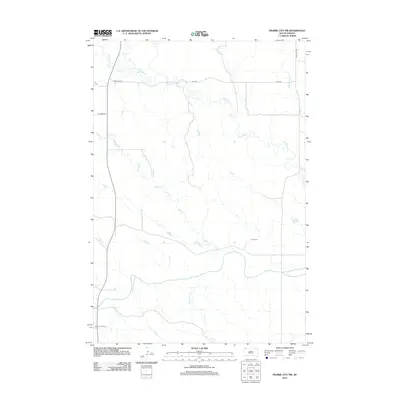
2012 Map of Prairie City NW
USGS Topo · Published 2012About this map
The S Fork Grand River and its network of tributaries define the high plains drainage of Harding County in this 2012 survey. This corner of South Dakota is characterized by a sparse, utilitarian road network including Abelseth Rd, Wagner Rd, and the north-south artery of Highway 79. Significant for genealogical research, the map identifies isolated burial sites such as Scion Cem and the South Grand River Cem, which serve as quiet markers of the area's rural heritage. The landscape is etched by seasonal watercourses with evocative local names like Big Nasty Cr, Middle Cr, and Gooseneck Cr, illustrating the hydrological patterns of the western dakotas. A few family-named roads like White Hill Rd provide the only other structural clues to the settlement history of this expansive prairie region.
Find a feature on this map
14 named features on this map. Tap any name to fly to it.
Don’t see what you’re looking for? This feature index may not catch every label — zoom into the map to look around manually.
Map Details
Editions of this 2012 Prairie City NW Map
This is the sole edition of this map. No revisions or reprints were ever made.
Other maps of this area

1935 · Reva
USGS Topo · 1:125,000

1954 · Lemmon
USGS Topo · 1:250,000

1957 · Lemmon
USGS Topo · 1:250,000

1968 · Reva
USGS Topo · 1:24,000

1968 · Ralph
USGS Topo · 1:24,000

1969 · Reva NE
USGS Topo · 1:24,000

1980 · Camp Crook
USGS Topo · 1:100,000

1983 · Cow Butte SE
USGS Topo · 1:24,000

1983 · Prairie City NE
USGS Topo · 1:24,000
1983 · Prairie City NW
USGS Topo · 1:24,000