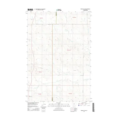
2015 Map of Prairie City NW
USGS Topo · Published 2015About this map
The South Fork Grand River meanders across this rural expanse of Harding and Perkins Counties, defining the drainage patterns of a landscape marked by intermittent watercourses. Tributaries such as Big Nasty Cr, Fivemile Cr, and Middle Cr flow through the surveyed townships, illustrating the sparse but vital water network of the South Dakota plains. The map records the intersection of Harding and Perkins Counties, providing a clear view of the township and range grid system during the early 21st century.
Find a feature on this map
21 named features on this map. Tap any name to fly to it.
Don’t see what you’re looking for? This feature index may not catch every label — zoom into the map to look around manually.
Map Details
Editions of this 2015 Prairie City NW Map
This is the sole edition of this map. No revisions or reprints were ever made.
Other maps of this area

1935 · Reva
USGS Topo · 1:125,000

1954 · Lemmon
USGS Topo · 1:250,000

1957 · Lemmon
USGS Topo · 1:250,000

1968 · Reva
USGS Topo · 1:24,000

1968 · Ralph
USGS Topo · 1:24,000

1969 · Reva NE
USGS Topo · 1:24,000

1980 · Camp Crook
USGS Topo · 1:100,000

1983 · Cow Butte SE
USGS Topo · 1:24,000

1983 · Prairie City NE
USGS Topo · 1:24,000
1983 · Prairie City NW
USGS Topo · 1:24,000