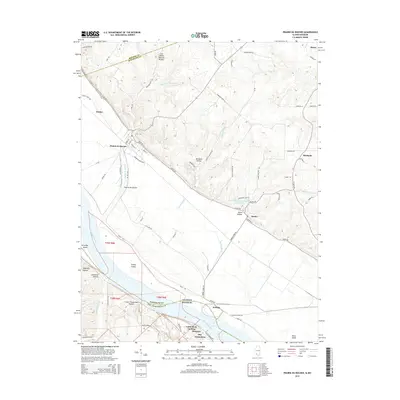
2015 Map of Prairie du Rocher
USGS Topo · Published 2015About this map
Prairie du Rocher sits at the base of a sharp limestone bluff line, marking a historic settlement point in the Illinois bottomlands. This 2015 survey details the geographic relationship between the highland bluffs and the wide floodplain of the Mississippi River. The landscape is defined by its drainage patterns, notably The Discharge and Prairie du Rocher Creek, which navigate the flat fields toward the river. To the south, across the state line in Missouri, the riverfront is dotted with small communities like Little Rock Landing, Thomure, and the northern edge of Ste. Genevieve. Unique natural features like Cow Shank Natural Bridge and several named ravines, including Barbeau Hollow and Burns Hollow, illustrate the complex topography where the plateau meets the river valley. The map also identifies local landmarks such as the Fort Chartres Sportsmans Club Lake and the river-deposited Turkey Island.
Find a feature on this map
76 named features on this map. Tap any name to fly to it.
Don’t see what you’re looking for? This feature index may not catch every label — zoom into the map to look around manually.
Map Details
Editions of this 2015 Prairie du Rocher Map
This is the sole edition of this map. No revisions or reprints were ever made.
Other maps of this area

1907 · Weingarten
USGS Topo · 1:62,500

1909 · Weingarten
USGS Topo · 1:62,500

1912 · Baldwin
USGS Topo · 1:62,500

1914 · Baldwin
USGS Topo · 1:62,500

1915 · Renault
USGS Topo · 1:62,500

1915 · Chester
USGS Topo · 1:62,500

1940 · Renault
USGS Topo · 1:62,500

1942 · Baldwin
USGS Topo · 1:62,500

1947 · Chester
USGS Topo · 1:62,500

1949 · Saint Louis
USGS Topo · 1:250,000