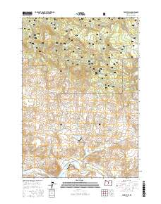
2017 Map of Prairie Hill
USGS Topo · Published 2017About this map
Ochoco National Forest dominates this high-country landscape, where narrow forest roads and seasonal water sources define the geography of northern Crook County. The northern terrain is centered on the namesake Prairie Hill, a high point surrounded by several small springs including Coin Spring, Little Horse Spring, and Goldie Spring. These vital water points, along with Black-Chunk Canyon and Horse Gulch, highlight the reliance on natural hydrology for ranching and forest management in this arid region.
Find a feature on this map
36 named features on this map. Tap any name to fly to it.
Don’t see what you’re looking for? This feature index may not catch every label — zoom into the map to look around manually.
Map Details
Editions of this 2017 Prairie Hill Map
This is the sole edition of this map. No revisions or reprints were ever made.
Other maps of this area

1951 · Post
USGS Topo · 1:62,500

1951 · Lookout Mtn
USGS Topo · 1:62,500

1955 · Bend
USGS Topo · 1:250,000

1957 · Bend
USGS Topo · 1:250,000

1958 · Bend
USGS Topo · 1:250,000

1965 · Williams Prairie
USGS Topo · 1:24,000

1981 · Prineville
USGS Topo · 1:100,000

1982 · Arrowwood Point
USGS Topo · 1:24,000
1983 · Committee Creek
USGS Topo · 1:24,000
1990 · Lookout Mountain
USGS Topo · 1:24,000