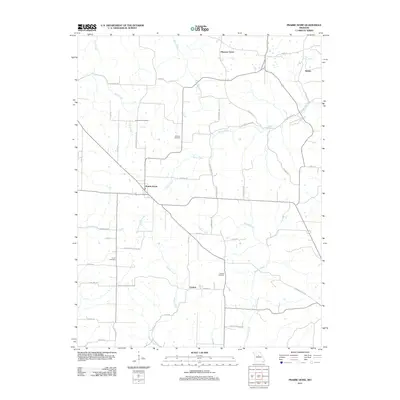
2011 Map of Prairie Home
USGS Topo · Published 2011About this map
Prairie Home serves as the central hub of this agricultural landscape in eastern Cooper County, where a network of rural roads connects several small settlements and family burial grounds. The terrain is defined by the drainage of Cave Creek and Splice Creek in the north, while Howard Creek and Schaaf Creek wind through the southern sections. This 2011 survey reflects the enduring rural character of the region, anchored by established hamlets like Pleasant Grove and Cedron.
Find a feature on this map
48 named features on this map. Tap any name to fly to it.
Don’t see what you’re looking for? This feature index may not catch every label — zoom into the map to look around manually.
Map Details
Editions of this 2011 Prairie Home Map
This is the sole edition of this map. No revisions or reprints were ever made.
Other maps of this area

1886 · Jefferson City
USGS Topo · 1:125,000

1888 · Boonville
USGS Topo · 1:125,000

1894 · Jefferson City
USGS Topo · 1:125,000

1947 · Jefferson City
USGS Topo · 1:250,000

1948 · Centertown
USGS Topo · 1:62,500

1948 · Columbia
USGS Topo · 1:62,500
1949 · Centertown
USGS Topo · 1:62,500

1950 · Columbia
USGS Topo · 1:62,500

1952 · Rocheport
USGS Topo · 1:24,000

1952 · Boonville
USGS Topo · 1:24,000