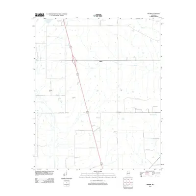
2012 Map of Prairie
USGS Topo · Published 2012About this map
Prairie and Gibson anchor this landscape in Monroe County, showing a rural Mississippi corridor defined by its drainage basins and local road network. The map detail highlights the winding paths of Chuquatonchee Cr, James Cr, and Hang Kettle Cr, illustrating how the hydrology dictated the placement of small community hubs and agricultural tracts. A sense of local history is preserved through the locations of the Patterson Cem, Coleman Cem, and Reedy Cem, which serve as vital markers for genealogical research in this part of the state.
Find a feature on this map
49 named features on this map. Tap any name to fly to it.
Don’t see what you’re looking for? This feature index may not catch every label — zoom into the map to look around manually.
Map Details
Editions of this 2012 Prairie Map
This is the sole edition of this map. No revisions or reprints were ever made.
Other maps of this area

1953 · West Point
USGS Topo · 1:250,000

1958 · West Point
USGS Topo · 1:250,000

1959 · West Point
USGS Topo · 1:62,500

1959 · Van Vleet
USGS Topo · 1:62,500

1959 · Pheba
USGS Topo · 1:62,500

1963 · West Point
USGS Topo · 1:250,000

1965 · Egypt
USGS Topo · 1:24,000

1966 · Aberdeen
USGS Topo · 1:24,000

1966 · Wren
USGS Topo · 1:24,000

1966 · Prairie
USGS Topo · 1:24,000