
1965 Map of Egypt
USGS Topo · Published 1967About this map
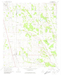
Okolona and the small railroad community of Egypt anchor this mid-1960s landscape along the boundary of Chickasaw Co Monroe Co. The Gulf Mobile and Ohio Railroad dictates the local geography, running north-south through a terrain defined by the meandering courses of Mattubby Creek and Sadler Creek. This era shows a transition from traditional agricultural patterns to modern infrastructure, evidenced by the presence of the Leuth Landing Strip alongside established country institutions. Genealogists will find a wealth of data in the numerous family and community landmarks, such as Darden Chapel, Pleasant Valley Cem, and the Leftwich Sch. The map preserves the specific locations of several small churches and cemeteries, including Ware Hill Cem and New Hebron Ch, which served the rural population before more intensive modernization changed the local character.
Find a feature on this map
32 named features on this map. Tap any name to fly to it.
Don’t see what you’re looking for? This feature index may not catch every label — zoom into the map to look around manually.
Map Details
Editions of this 1965 Egypt Map
2 editions found
Other maps of this area

1953 · West Point
USGS Topo · 1:250,000

1956 · Tupelo
USGS Topo · 1:250,000

1958 · Tupelo
USGS Topo · 1:250,000

1958 · West Point
USGS Topo · 1:250,000

1959 · Van Vleet
USGS Topo · 1:62,500

1963 · West Point
USGS Topo · 1:250,000

1966 · Aberdeen
USGS Topo · 1:24,000

1966 · Shannon
USGS Topo · 1:24,000

1966 · Wren
USGS Topo · 1:24,000

1966 · Prairie
USGS Topo · 1:24,000