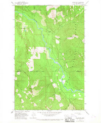
1966 Map of Prairie Mtn.
USGS Topo · Published 1968About this map
The Suiattle River carves a deep valley through the wilderness of the Mount Baker National Forest, following a winding course that defines the topography of this Cascade Range landscape in the mid-1960s. High alpine features like Prairie Mountain and Huckleberry Mtn loom over a network of glacial tributaries, including Big Creek and Tenas Creek. The presence of the Suiattle Cemetery near the riverbank suggests early human activity and settlement history in a region otherwise dominated by timber and terrain. Surveyed just before the expansion of modern forest road systems, the map shows several isolated landmarks such as Teepee Falls and the Prairie Mountain Lakes, offering a detailed view of the drainage patterns and peaks along the Skagit and Snohomish County boundary line.
Find a feature on this map
19 named features on this map. Tap any name to fly to it.
Don’t see what you’re looking for? This feature index may not catch every label — zoom into the map to look around manually.
Map Details
Editions of this 1966 Prairie Mtn. Map
2 editions found
Other maps of this area

1899 · Glacier Peak
USGS Topo · 1:125,000

1899 · Stillaguamish
USGS Topo · 1:125,000

1901 · Glacier Peak
USGS Topo · 1:125,000

1901 · Stilaguamish
USGS Topo · 1:125,000

1955 · Concrete
USGS Topo · 1:250,000

1957 · Silverton
USGS Topo · 1:62,500

1958 · Concrete
USGS Topo · 1:250,000

1962 · Concrete
USGS Topo · 1:250,000
1966 · Snowking Mtn.
USGS Topo · 1:24,000
1966 · Huckleberry Mtn
USGS Topo · 1:24,000