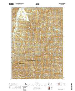
2020 Map of Prairie Peak
USGS Topo · Published 2020About this map
The Benton Co Lane Co boundary bisects this high-elevation region of the Oregon Coast Range, dominated by the prominent summits of Prairie Peak and Prairie Mtn. This terrain is defined by a dense network of timber access roads and steep drainage basins, including the headwaters of the S Fork Alsea River and the winding Little Lobster Cr. The landscape transitions from the ridges of Bummer Ridge down toward Billy Tower Canyon in the southeast. While largely an industrial forest landscape, the presence of the Gygi and Engle Reservoir and named crossings like Gunsight Pass indicate specific points of local activity. Researchers will find a meticulously documented system of Bureau of Land Management routes, such as the Fall Creek Access Rd, which provide a framework for understanding the region's long-standing logging and water management infrastructure.
Find a feature on this map
58 named features on this map. Tap any name to fly to it.
Don’t see what you’re looking for? This feature index may not catch every label — zoom into the map to look around manually.
Map Details
Editions of this 2020 Prairie Peak Map
This is the sole edition of this map. No revisions or reprints were ever made.
Other maps of this area

1909 · Elmira
USGS Topo · 1:62,500

1922 · Monroe
USGS Topo · 1:62,500

1922 · Elmira
USGS Topo · 1:62,500

1939 · Monroe
USGS Topo · 1:62,500

1941 · Blachly
USGS Topo · 1:62,500

1942 · Alsea
USGS Topo · 1:62,500

1942 · Elmira
USGS Topo · 1:62,500

1942 · Blachly
USGS Topo · 1:62,500

1942 · Monroe
USGS Topo · 1:62,500

1953 · Salem
USGS Topo · 1:250,000