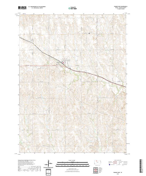
2022 Map of Prairie View
USGS Topo · Published 2022About this map
Prairie View serves as the central hub of this northern Kansas landscape, where a precise grid of rural routes like W Mohawk Rd and W Navajo Rd organizes the surrounding farmland. The settlement is anchored by local landmarks such as Prairie View Cem and the nearby Van Pak Airport. The terrain is defined by a series of drainage systems, including the winding paths of Beaver Cr, Deer Cr, and Crooked Cr, which cut through the agricultural sections. Farther north, the presence of Luctor Cem marks a distinct point of local interest for genealogists tracing family roots in Phillips County. This 2022 survey captures the enduring rural character of the region, where the section-line road system remains the primary infrastructure for the area's agricultural economy.
Find a feature on this map
29 named features on this map. Tap any name to fly to it.
Don’t see what you’re looking for? This feature index may not catch every label — zoom into the map to look around manually.
Map Details
Editions of this 2022 Prairie View Map
This is the sole edition of this map. No revisions or reprints were ever made.
Other maps of this area

1893 · Norton
USGS Topo · 1:125,000

1893 · Phillipsburg
USGS Topo · 1:125,000

1955 · Beloit
USGS Topo · 1:250,000

1959 · Beloit
USGS Topo · 1:250,000
1967 · Almena
USGS Topo · 1:24,000
1967 · Long Island
USGS Topo · 1:24,000

1968 · Woodruff
USGS Topo · 1:24,000

1972 · Speed
USGS Topo · 1:24,000
1973 · Stuttgart
USGS Topo · 1:24,000

1978 · Logan
USGS Topo · 1:24,000