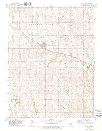
1978 Map of Prairie View
USGS Topo · Published 1979About this map
Prairie View serves as the central hub of this northern Kansas landscape during the late 1970s, where the Chicago Rock Island and Pacific railroad cuts a diagonal line through the town and surrounding townships. This intersection of infrastructure and agriculture is further marked by the Van-Pak Landing Strip and a prominent Water Tank near the tracks. The map details the rural character of Prairie View, Beaver, and Dayton townships, revealing a network of section roads connecting family-linked sites such as Luctor Ch and Luctor Cem in the northeast.
Find a feature on this map
18 named features on this map. Tap any name to fly to it.
Don’t see what you’re looking for? This feature index may not catch every label — zoom into the map to look around manually.
Map Details
Editions of this 1978 Prairie View Map
This is the sole edition of this map. No revisions or reprints were ever made.
Other maps of this area

1893 · Norton
USGS Topo · 1:125,000

1893 · Phillipsburg
USGS Topo · 1:125,000

1955 · Beloit
USGS Topo · 1:250,000

1959 · Beloit
USGS Topo · 1:250,000
1967 · Almena
USGS Topo · 1:24,000
1967 · Long Island
USGS Topo · 1:24,000

1968 · Woodruff
USGS Topo · 1:24,000

1972 · Speed
USGS Topo · 1:24,000
1973 · Stuttgart
USGS Topo · 1:24,000

1978 · Logan
USGS Topo · 1:24,000