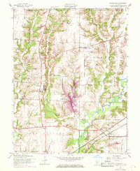
1954 Map of Prairietown
USGS Topo · Published 1969About this map
Cahokia Creek and its complex network of tributaries, including Paddock Creek and Sherry Creek, define the rural character of this Madison County landscape. The mid-century development of Holiday Shores stands as a prominent residential feature, contrasting with the older agrarian settlements like Prairietown and Dorsey. A robust railroad infrastructure transitions through the area, with the Chicago and North Western, Norfolk and Western, and Illinois Terminal lines providing vital links for the regional economy.
Find a feature on this map
32 named features on this map. Tap any name to fly to it.
Don’t see what you’re looking for? This feature index may not catch every label — zoom into the map to look around manually.
Map Details
Editions of this 1954 Prairietown Map
3 editions found
Other maps of this area

1912 · Gillespie
USGS Topo · 1:62,500

1915 · Gillespie
USGS Topo · 1:62,500

1925 · Brighton
USGS Topo · 1:62,500

1927 · Alton
USGS Topo · 1:62,500

1927 · Edwardsville
USGS Topo · 1:62,500

1928 · Brighton
USGS Topo · 1:62,500

1932 · Edwardsville
USGS Topo · 1:62,500

1934 · Alton
USGS Topo · 1:62,500

1948 · Quincy
USGS Topo · 1:250,000

1948 · Wood River
USGS Topo · 1:24,000