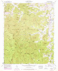
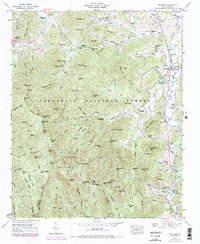
1946 Map of Prentiss
USGS Topo · Published 1978About this map
The Appalachian Trail winds through the high ridges of the Nantahala National Forest in this 1946 survey of Macon County, updated with 1970s aerial data. The landscape is defined by the steep elevation change from peaks like Albert Mtn and Yellow Bald down to the fertile valleys of the Little River and Tennessee River. This region exhibits a distinct mountain economy focused on the water power of the creeks, evidenced by several sites including Addington Mill, McClure Mill, and McDonald Mill.
Find a feature on this map
125 named features on this map. Tap any name to fly to it.
Don’t see what you’re looking for? This feature index may not catch every label — zoom into the map to look around manually.
Map Details
Editions of this 1946 Prentiss Map
5 editions found
Other maps of this area

1886 · Dahlonega
USGS Topo · 1:125,000

1886 · Walhalla
USGS Topo · 1:125,000

1891 · Cowee
USGS Topo · 1:125,000

1892 · Dahlonega
USGS Topo · 1:125,000

1892 · Walhalla
USGS Topo · 1:125,000

1896 · Walhalla
USGS Topo · 1:125,000

1896 · Dahlonega
USGS Topo · 1:125,000

1897 · Cowee
USGS Topo · 1:125,000

1903 · Dahlonega
USGS Topo · 1:125,000

1907 · Cowee
USGS Topo · 1:125,000