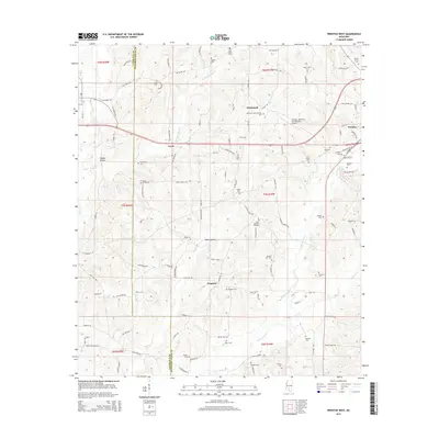
2015 Map of Prentiss West
USGS Topo · Published 2015About this map
The town of Prentiss serves as a focal point in this Jefferson Davis County landscape, where the Prentiss-Jefferson Davis County Airport marks the transition from the town's grid to the surrounding rural reaches. The area is defined by its deep genealogical roots, visible in the numerous family and community burial grounds such as Patterson-Garner-Loftin Cem, South Pleasant Hill Cem, and Stamps Cem. Small settlements like Whitesand, Lucas, and Progress are connected by a network of local roads including Daughdrill Rd and Spring Hill Rd. The terrain is characterized by distinct drainage patterns like White Sand Cr and Silver Cr, alongside named depressions such as Hooker Hollow and Watts Hollow, which have historically influenced the placement of farms and homesteads in this part of Mississippi.
Find a feature on this map
109 named features on this map. Tap any name to fly to it.
Don’t see what you’re looking for? This feature index may not catch every label — zoom into the map to look around manually.
Map Details
Editions of this 2015 Prentiss West Map
This is the sole edition of this map. No revisions or reprints were ever made.
Other maps of this area

1953 · Hattiesburg
USGS Topo · 1:250,000

1953 · Natchez
USGS Topo · 1:250,000

1956 · Natchez
USGS Topo · 1:250,000

1958 · Hattiesburg
USGS Topo · 1:250,000

1959 · Natchez
USGS Topo · 1:250,000

1970 · Prentiss West
USGS Topo · 1:24,000

1970 · Monticello
USGS Topo · 1:24,000

1970 · Bunker Hill
USGS Topo · 1:24,000

1970 · Oak Vale
USGS Topo · 1:24,000

1970 · New Hebron
USGS Topo · 1:24,000