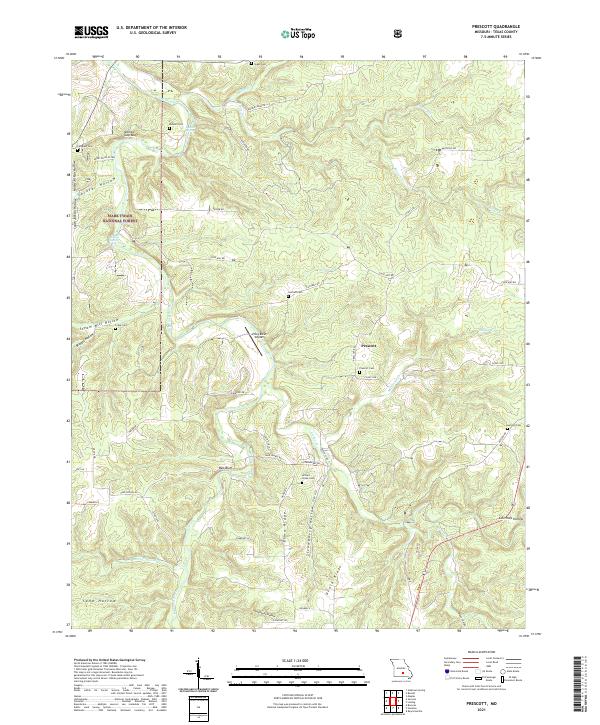
2021 Map of Prescott
USGS Topo · Published 2021About this map
The Big Piney River winds through the heart of this landscape in Texas County, carving out significant terrain markers like Narrow Gap Bluff and Piney Bend Airport. The small community of Prescott serves as a central point, surrounded by a high density of family-named burial grounds that offer valuable data for genealogists, including Sliger Cem, Burnett Cem, and the Arthurs Creek Cem. This area of the Ozark plateau is defined by its deep hollows and high ridges, such as Elmo Ridge and Dzurk Ridge, which dictate the winding paths of rural routes like State HWY BB and Highway E. Portions of the Mark Twain National Forest and lands under the Farm Service Agency Interest of Missouri indicate a mix of protected timberland and agricultural management. Water features like Boiling Spring and Burnett Spring highlight the region's karstic nature, while the river provides recreation and transport via the Henry River Access.
Find a feature on this map
61 named features on this map. Tap any name to fly to it.
Don’t see what you’re looking for? This feature index may not catch every label — zoom into the map to look around manually.
Map Details
Editions of this 2021 Prescott Map
This is the sole edition of this map. No revisions or reprints were ever made.
Other maps of this area

1937 · Edgar Springs
USGS Topo · 1:48,000

1941 · Big Piney
USGS Topo · 1:62,500

1941 · Bado
USGS Topo · 1:62,500

1943 · Big Piney
USGS Topo · 1:62,500

1943 · Bado
USGS Topo · 1:62,500

1945 · Edgar Springs
USGS Topo · 1:62,500

1949 · Rolla
USGS Topo · 1:250,000

1951 · Licking
USGS Topo · 1:24,000

1951 · Raymondville
USGS Topo · 1:24,000

1951 · Prescott
USGS Topo · 1:24,000