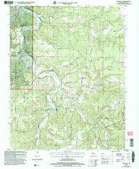
2004 Map of Prescott
USGS Topo · Published 2006About this map
The Big Piney River carves a deep path through the northern reaches of the Mark Twain National Forest, defining a landscape of high bluffs and narrow hollows. In this part of Texas County, the topography is marked by significant names from the region's rural past, including numerous sites of former educational and social centers like Pine Grove Sch and Venable Sch. The small settlement of Prescott serves as a central point, supported by Prescott Ch and nearby Prescott Cem. Historically, the area relied on water sources and natural landmarks for orientation, as seen in the labeling of Boiling Spring, Burnett Spring, and Sandy Shoals Ford. The transition from river bottomlands to the ridges is traversed by local thoroughfares such as Hartville Road and Venable Drive, which connect the scattered cemeteries and homesteads across the varied terrain.
Find a feature on this map
51 named features on this map. Tap any name to fly to it.
Don’t see what you’re looking for? This feature index may not catch every label — zoom into the map to look around manually.
Map Details
Editions of this 2004 Prescott Map
This is the sole edition of this map. No revisions or reprints were ever made.
Other maps of this area

1937 · Edgar Springs
USGS Topo · 1:48,000

1941 · Big Piney
USGS Topo · 1:62,500

1941 · Bado
USGS Topo · 1:62,500

1943 · Big Piney
USGS Topo · 1:62,500

1943 · Bado
USGS Topo · 1:62,500

1945 · Edgar Springs
USGS Topo · 1:62,500

1949 · Rolla
USGS Topo · 1:250,000

1951 · Licking
USGS Topo · 1:24,000

1951 · Raymondville
USGS Topo · 1:24,000

1951 · Prescott
USGS Topo · 1:24,000