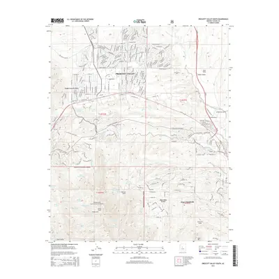
2014 Map of Prescott Valley South
USGS Topo · Published 2014About this map
Prescott National Forest dominates the southern half of this landscape, where the terrain transitions from the developed streets of Prescott Valley into a complex network of canyons and gulches. The high desert hydrology is defined by numerous seasonal drainages and stock tanks such as White Horse Tank and Upper Salida Tank, which support the livestock and wildlife of the region. To the east, the settlement of Dewey-Humboldt sits near the banks of the Agua Fria River, an area with deep roots in Arizona's mining and ranching history.
Find a feature on this map
162 named features on this map. Tap any name to fly to it.
Don’t see what you’re looking for? This feature index may not catch every label — zoom into the map to look around manually.
Map Details
Editions of this 2014 Prescott Valley South Map
This is the sole edition of this map. No revisions or reprints were ever made.
Other maps of this area

1887 · Prescott
USGS Topo · 1:250,000

1892 · Prescott
USGS Topo · 1:250,000

1903 · Bradshaw Mountains
USGS Topo · 1:125,000

1905 · Jerome
USGS Topo · 1:125,000

1944 · Mingus Mountain
USGS Topo · 1:62,500

1947 · Mingus Mtn
USGS Topo · 1:62,500

1947 · Mayer
USGS Topo · 1:62,500

1947 · Mt. Union
USGS Topo · 1:62,500

1947 · Prescott
USGS Topo · 1:62,500

1948 · Mt. Union
USGS Topo · 1:63,360
Featured Places
- Prescott Valley, AZ
- Dewey-Humboldt, AZ
- Blue Hills Farms, Dewey-Humboldt
- Yavapai County, AZ
- United States