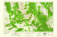
1960 Map of Prescott
USGS Topo · Published 1960About this map
Prescott serves as the central hub of this mid-century Yavapai County landscape, where the sprawling Prescott National Forest meets a network of mining operations and isolated mountain outposts. The map documents the industrial footprint of the era, highlighting major extractions at the Bagdad Mine, Iron King Mine, and the United Verde Mine near Jerome. These operations are linked by the winding routes of the Atchison Topeka and Santa Fe railroad, which threads through difficult terrain like the Bradshaw Mountains and Aquarius Mountains. Smaller settlements such as Bumble Bee, Skull Valley, and Swansea provide a detailed look at rural Arizona life before modern expansion. Significant landmarks like the Fort Whipple Military Reservation and various ranger stations, including Walnut Creek Ranger Station, illustrate the management of public lands and the military's long-standing presence in the region.
Find a feature on this map
159 named features on this map. Tap any name to fly to it.
Don’t see what you’re looking for? This feature index may not catch every label — zoom into the map to look around manually.
Map Details
Editions of this 1960 Prescott Map
2 editions found

Other maps of this area

1886 · Diamond Creek
USGS Topo · 1:250,000

1886 · Camp Mohave
USGS Topo · 1:250,000

1886 · San Francisco Mtns
USGS Topo · 1:250,000

1886 · Chino
USGS Topo · 1:250,000

1887 · Verde
USGS Topo · 1:250,000

1887 · Prescott
USGS Topo · 1:250,000

1891 · San Francisco Mtns
USGS Topo · 1:250,000

1891 · Chino
USGS Topo · 1:250,000

1892 · Verde
USGS Topo · 1:250,000

1892 · Diamond Creek
USGS Topo · 1:250,000