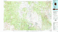
1981 Map of Prescott
USGS Topo · Published 1996About this map
Prescott National Forest dominates this central Arizona landscape, providing a backdrop to the early 1980s growth of Prescott and the development of Prescott Valley. The map details a transition from the high-desert basins of Chino Valley and Williamson Valley to the mining-rich slopes of the Black Hills. Legacy mining operations are prominent throughout the region, including the United Verde Mine near Clarkdale and the Iron King Mine near Humboldt.
Find a feature on this map
71 named features on this map. Tap any name to fly to it.
Don’t see what you’re looking for? This feature index may not catch every label — zoom into the map to look around manually.
Map Details
Editions of this 1981 Prescott Map
2 editions found
Other maps of this area

1886 · Diamond Creek
USGS Topo · 1:250,000

1886 · San Francisco Mtns
USGS Topo · 1:250,000

1886 · Chino
USGS Topo · 1:250,000

1887 · Verde
USGS Topo · 1:250,000

1887 · Prescott
USGS Topo · 1:250,000

1891 · San Francisco Mtns
USGS Topo · 1:250,000

1891 · Chino
USGS Topo · 1:250,000

1892 · Verde
USGS Topo · 1:250,000

1892 · Diamond Creek
USGS Topo · 1:250,000

1892 · Prescott
USGS Topo · 1:250,000