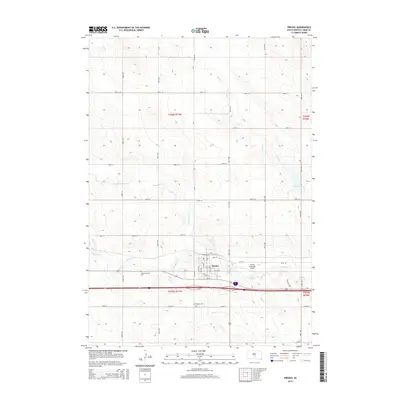
2015 Map of Presho
USGS Topo · Published 2015About this map
Presho serves as the central hub of this Lyman County landscape, where the grid of the town site meets the winding course of Medicine Creek. This survey captures the town's infrastructure, including the Presho Municipal Airport and the intersection of local routes like CR 22 with the interstate corridor. The surrounding prairie is defined by a series of drainage systems, such as Stony Butte Creek and Nail Creek, which feed into local water features like Fate Dam. For those tracing local history or family ties, the map provides precise locations for the Medicine Creek Cemetery and Holy Angels Cemetery, situated near the town center. The geographic transition from the residential streets like Willow Street and Birch Avenue to the open ranching and agricultural lands of the Missouri Plateau is clearly delineated by the township and range boundaries of t106n r77w and t105n r77w.
Find a feature on this map
39 named features on this map. Tap any name to fly to it.
Don’t see what you’re looking for? This feature index may not catch every label — zoom into the map to look around manually.
Map Details
Editions of this 2015 Presho Map
This is the sole edition of this map. No revisions or reprints were ever made.
Other maps of this area

1953 · Huron
USGS Topo · 1:250,000

1954 · Pierre
USGS Topo · 1:250,000

1954 · Huron
USGS Topo · 1:250,000

1955 · Martin
USGS Topo · 1:250,000

1955 · Mitchell
USGS Topo · 1:250,000

1958 · Pierre
USGS Topo · 1:250,000

1958 · Martin
USGS Topo · 1:250,000

1959 · Mitchell
USGS Topo · 1:250,000

1966 · Ft. George Butte SE
USGS Topo · 1:24,000
1966 · Joe Creek SW
USGS Topo · 1:24,000