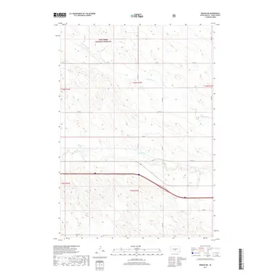
2017 Map of Presho NW
USGS Topo · Published 2017About this map
Fort Pierre National Grassland dominates the northern reaches of this Lyman County landscape, preserving the open character of the South Dakota prairie as it appeared in the 21st century. The terrain is defined by the winding drainages of Stony Butte Cr and Medicine Cr, which carve through the high plains. A grid of section roads, including 236th St and 243rd St, provides access to the agricultural interior. Historically significant transportation corridors traverse the southern half of the map, where the path of Old Hwy 16 runs parallel to modern transit routes. This survey highlights the geographic transition between protected federal grasslands and the private ranchlands that characterize the region's rural economy.
Find a feature on this map
14 named features on this map. Tap any name to fly to it.
Don’t see what you’re looking for? This feature index may not catch every label — zoom into the map to look around manually.
Map Details
Editions of this 2017 Presho NW Map
This is the sole edition of this map. No revisions or reprints were ever made.
Other maps of this area

1954 · Pierre
USGS Topo · 1:250,000

1955 · Martin
USGS Topo · 1:250,000

1958 · Pierre
USGS Topo · 1:250,000

1958 · Martin
USGS Topo · 1:250,000

1966 · Ft. George Butte SE
USGS Topo · 1:24,000

1967 · Ft. George Butte SW
USGS Topo · 1:24,000

1972 · Pierre 3 SE
USGS Topo · 1:24,000

1972 · Vivian
USGS Topo · 1:24,000

1972 · Vivian SE
USGS Topo · 1:24,000
1978 · Presho
USGS Topo · 1:24,000