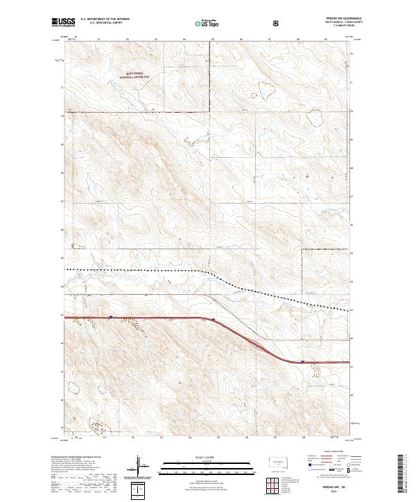
2021 Map of Presho NW
USGS Topo · Published 2021About this map
Fort Pierre National Grassland dominates the northern reaches of this Lyman County landscape, preserving a vast expanse of mixed-grass prairie. The terrain is defined by the drainage patterns of Medicine Cr and Stony Butte Cr, which carve through the undulating plains. Transportation history is visible in the alignment of Old Hwy 16, running parallel to modern transit routes and reflecting the evolution of cross-state travel in South Dakota. The map meticulously records the section lines and township boundaries, including t106n r78w, that have organized these agricultural and grazing lands since initial settlement. Local access is provided by a grid of rural roads such as 300th Ave and 236th St, which serve the scattered farmsteads and ranching operations characteristic of the region.
Find a feature on this map
18 named features on this map. Tap any name to fly to it.
Don’t see what you’re looking for? This feature index may not catch every label — zoom into the map to look around manually.
Map Details
Editions of this 2021 Presho NW Map
This is the sole edition of this map. No revisions or reprints were ever made.
Other maps of this area

1954 · Pierre
USGS Topo · 1:250,000

1955 · Martin
USGS Topo · 1:250,000

1958 · Pierre
USGS Topo · 1:250,000

1958 · Martin
USGS Topo · 1:250,000

1966 · Ft. George Butte SE
USGS Topo · 1:24,000

1967 · Ft. George Butte SW
USGS Topo · 1:24,000

1972 · Pierre 3 SE
USGS Topo · 1:24,000

1972 · Vivian
USGS Topo · 1:24,000

1972 · Vivian SE
USGS Topo · 1:24,000
1978 · Presho
USGS Topo · 1:24,000