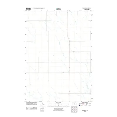
2012 Map of Presho SE
USGS Topo · Published 2012About this map
Mill Iron Cr meanders through the heart of this Lyman County landscape, defining the local drainage patterns across a wide expanse of prairie land. The area is characterized by a sparse grid of rural thoroughfares, including the arterial 183 and the Jones Co Hwy S9, which facilitate movement across the open terrain. Smaller watercourses like Mission Creek touch the southwestern reaches of the sheet, providing subtle geographic variety to the largely agricultural and pastoral setting. This 2012 survey documents the section-line road system common to the Great Plains, where routes like 247th St and 249th St represent the primary human imprint on an otherwise natural landscape defined by seasonal creek beds.
Find a feature on this map
6 named features on this map. Tap any name to fly to it.
Don’t see what you’re looking for? This feature index may not catch every label — zoom into the map to look around manually.
Map Details
Editions of this 2012 Presho SE Map
This is the sole edition of this map. No revisions or reprints were ever made.
Other maps of this area

1951 · Presho 4 NE
USGS Topo · 1:24,000

1951 · Ideal NW
USGS Topo · 1:24,000

1951 · Presho 4 NW
USGS Topo · 1:24,000

1955 · Martin
USGS Topo · 1:250,000

1955 · Mitchell
USGS Topo · 1:250,000

1958 · Martin
USGS Topo · 1:250,000

1959 · Mitchell
USGS Topo · 1:250,000
1978 · Presho
USGS Topo · 1:24,000
1978 · Brakke Dam
USGS Topo · 1:24,000

1978 · Kennebec SW
USGS Topo · 1:24,000