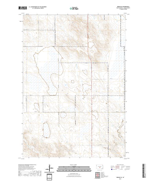
2021 Map of Presho SE
USGS Topo · Published 2021About this map
The rolling prairies of Lyman County are defined by a strict section-line road network and the meandering drainages of the Missouri River plateau. Mill Iron Cr and Mission Cr thread through the draws, providing natural breaks in the geometric grid of agricultural land. The map illustrates a late-twentieth and early-twenty-first-century landscape where transportation is dominated by long north-south corridors such as 304th Ave and 302nd Ave, which intersect with east-west section roads like 248th St. This layout reflects the enduring legacy of the Public Land Survey System, with township boundaries for t104n r77w and t103n r77w organizing the sparse but persistent ranching and farming operations of south-central South Dakota.
Find a feature on this map
17 named features on this map. Tap any name to fly to it.
Don’t see what you’re looking for? This feature index may not catch every label — zoom into the map to look around manually.
Map Details
Editions of this 2021 Presho SE Map
This is the sole edition of this map. No revisions or reprints were ever made.
Other maps of this area

1951 · Presho 4 NE
USGS Topo · 1:24,000

1951 · Ideal NW
USGS Topo · 1:24,000

1951 · Presho 4 NW
USGS Topo · 1:24,000

1955 · Martin
USGS Topo · 1:250,000

1955 · Mitchell
USGS Topo · 1:250,000

1958 · Martin
USGS Topo · 1:250,000

1959 · Mitchell
USGS Topo · 1:250,000
1978 · Presho
USGS Topo · 1:24,000
1978 · Brakke Dam
USGS Topo · 1:24,000

1978 · Kennebec SW
USGS Topo · 1:24,000