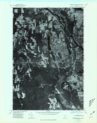
1975 Map of Presque Isle NE
USGS Topo · Published 1981About this map
Presque Isle serves as the focal point of this orthophotomap, where the urban grid and industrial development meet the productive agricultural lands of Aroostook County. Unlike a traditional topographic sheet, this aerial perspective provides a precise look at the 1970s land use patterns, revealing the density of the town center at the confluence of the Aroostook River and Presque Isle Stream. North of the main settlement, the Caribou Road corridor shows early signs of commercial expansion, while the outlying area of Rands remains dominated by large field plots.
Find a feature on this map
8 named features on this map. Tap any name to fly to it.
Don’t see what you’re looking for? This feature index may not catch every label — zoom into the map to look around manually.
Map Details
Editions of this 1975 Presque Isle NE Map
This is the sole edition of this map. No revisions or reprints were ever made.
Other maps of this area

1929 · Caribou
USGS Topo · 1:48,000

1930 · Fort Fairfield
USGS Topo · 1:48,000

1932 · Caribou
USGS Topo · 1:62,500

1933 · Fort Fairfield
USGS Topo · 1:62,500

1935 · Presque Isle
USGS Topo · 1:62,500

1936 · Mars Hill
USGS Topo · 1:48,000

1940 · Mars Hill
USGS Topo · 1:62,500

1951 · Mars Hill
USGS Topo · 1:62,500

1951 · Fort Fairfield
USGS Topo · 1:62,500

1953 · Presque Isle
USGS Topo · 1:62,500