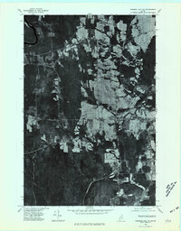
1975 Map of Presque Isle NW
USGS Topo · Published 1981About this map
Agricultural fields and dense woodlands define this 1975 orthophoto centered on the township of Mapleton in northern Maine. The imagery reveals the mid-1970s land-use patterns of the Aroostook County potato-growing region, showing the distinct contrast between the cleared, geometric plots along State Road and the heavily forested peaks of Haystack Mountain and Pyle Mountain. Further south, the settlement of Chapman sits near the winding course of the North Branch Presque Isle Stream, which drains the eastern portion of the quadrangle. This aerial perspective captures the rural character of the area just before the 1980s, highlighting how the local topography, including elevations like Garland Hill, dictated the expansion of local farms and road networks through the woods.
Find a feature on this map
7 named features on this map. Tap any name to fly to it.
Don’t see what you’re looking for? This feature index may not catch every label — zoom into the map to look around manually.
Map Details
Editions of this 1975 Presque Isle NW Map
This is the sole edition of this map. No revisions or reprints were ever made.
Other maps of this area

1929 · Portage
USGS Topo · 1:62,500

1929 · Caribou
USGS Topo · 1:48,000

1931 · Ashland
USGS Topo · 1:48,000

1931 · Portage
USGS Topo · 1:62,500

1932 · Caribou
USGS Topo · 1:62,500

1934 · Ashland
USGS Topo · 1:62,500

1935 · Presque Isle
USGS Topo · 1:62,500

1953 · Ashland
USGS Topo · 1:62,500

1953 · Portage
USGS Topo · 1:62,500

1953 · Presque Isle
USGS Topo · 1:62,500