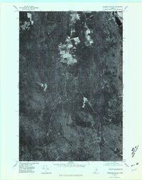
1975 Map of Presque Isle SE
USGS Topo · Published 1981About this map
Presque Isle Stream meanders through the heart of this orthophotoquad, revealing a landscape defined by its waterways and clearing patterns in the mid-1970s. The aerial imagery highlights the sharp contrast between the dense woodlands and the geometric shapes of agricultural fields that cling to the higher ground near Quaggy Joe. To the east, the waters of Echo Lake stand out against the forest cover, while Burnt Land Brook cuts through the southern reaches of the quadrangle. This document provides a unique visual record of the land use and timber patterns before the expansion of modern infrastructure, showing the relationship between the elevated terrain of Green Mountain and the drainage systems that feed into the larger Presque Isle watershed.
Find a feature on this map
5 named features on this map. Tap any name to fly to it.
Don’t see what you’re looking for? This feature index may not catch every label — zoom into the map to look around manually.
Map Details
Editions of this 1975 Presque Isle SE Map
This is the sole edition of this map. No revisions or reprints were ever made.
Other maps of this area

1934 · Bridgewater
USGS Topo · 1:48,000

1935 · Howe Brook
USGS Topo · 1:48,000

1935 · Presque Isle
USGS Topo · 1:62,500

1936 · Mars Hill
USGS Topo · 1:48,000

1938 · Bridgewater
USGS Topo · 1:62,500

1939 · Howe Brook
USGS Topo · 1:62,500

1940 · Mars Hill
USGS Topo · 1:62,500

1951 · Mars Hill
USGS Topo · 1:62,500

1951 · Bridgewater
USGS Topo · 1:62,500

1953 · Bridgewater
USGS Topo · 1:50,000