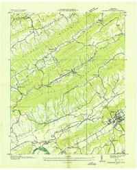
1935 Map of Pressmens Home
USGS Topo · Published 1935About this map
Clinch Mountain and Copper Ridge dominate this East Tennessee landscape, forcing a series of parallel valleys where communities like Pressmens Home and Alumwell took root. In 1935, the Tennessee Valley Authority and USGS recorded this transition between the steep ridges and the Holston River lowlands to the south. The map identifies the headquarters of the International Printing Pressmen and Assistants' Union at Pressmens Home, complete with its own Memorial Chapel and dedicated transmission line, representing a unique pocket of organized labor and institutional development in rural Hawkins County.
Find a feature on this map
70 named features on this map. Tap any name to fly to it.
Don’t see what you’re looking for? This feature index may not catch every label — zoom into the map to look around manually.
Map Details
Editions of this 1935 Pressmens Home Map
This is the sole edition of this map. No revisions or reprints were ever made.
Other maps of this area

1883 · Morristown
USGS Topo · 1:125,000

1887 · Jonesville
USGS Topo · 1:125,000

1891 · Jonesville
USGS Topo · 1:125,000

1892 · Greeneville
USGS Topo · 1:125,000

1893 · Morristown
USGS Topo · 1:125,000

1894 · Estillville
USGS Topo · 1:125,000

1895 · Morristown
USGS Topo · 1:125,000

1896 · Greeneville
USGS Topo · 1:125,000

1904 · Greeneville
USGS Topo · 1:125,000

1935 · Surgoinsville
USGS Topo · 1:48,000