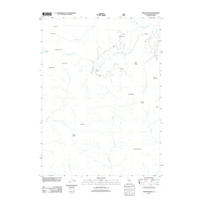
2012 Map of Preston Peak
USGS Topo · Published 2012About this map
Preston Peak and its surrounding high-altitude terrain dominate this Siskiyou County landscape, defined by a complex network of ridges and glacial basins. The drainage pattern is led by the S Fork Indian Cr and its numerous tributaries, including the W Fork Little S Fork Indian Cr and Tenmile Cr. This 2012 survey illustrates the remote character of the Klamath Mountains, where high points like El Capitan, Boulder Peak, and Copper Mountain rise above deep basins such as Cedar Basin. Human presence is minimal, primarily concentrated at the small settlements of Little Preston and Cedar Crest, and along specialized forestry routes like Forest Rte 17N27. The map captures a high-country environment where prominent divides like the Five-and-Ten Divide separate major watersheds, while landmarks such as Raspberry Lake and Elk Lick serve as key identifiers in the backcountry.
Find a feature on this map
33 named features on this map. Tap any name to fly to it.
Don’t see what you’re looking for? This feature index may not catch every label — zoom into the map to look around manually.
Map Details
Editions of this 2012 Preston Peak Map
This is the sole edition of this map. No revisions or reprints were ever made.
Other maps of this area

1914 · Seiad
USGS Topo · 1:125,000

1922 · Preston Peak
USGS Topo · 1:125,000

1922 · Seiad
USGS Topo · 1:125,000

1948 · Weed
USGS Topo · 1:250,000

1950 · Weed
USGS Topo · 1:250,000

1955 · Dillon Mtn
USGS Topo · 1:62,500

1955 · Ukonom Lake
USGS Topo · 1:62,500

1956 · Happy Camp
USGS Topo · 1:62,500

1956 · Preston Peak
USGS Topo · 1:62,500

1958 · Weed
USGS Topo · 1:250,000