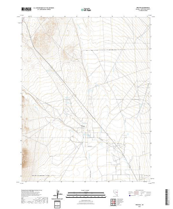
2021 Map of Preston
USGS Topo · Published 2021About this map
The community of Preston lies within the White River Valley, where the landscape is defined by its vital water sources. This portion of White Pine County relies on a network of springs and reservoirs, including Preston Big Spring, McQuinty Spring, and the Blackjack Reservoir. The settlement pattern follows the drainage of the White River and Jakes Wash, with agricultural and ranching life structured around the local roads like Preston Ave and the Preston Loop. This map documents a high-desert valley where traditional water management remains central to the geography. Numerous smaller sources such as Arnoldson Spring, Nicholas Spring, and Cold Spring are situated near the town, highlighting the concentration of water rights that have supported this rural Nevada enclave for generations.
Find a feature on this map
23 named features on this map. Tap any name to fly to it.
Don’t see what you’re looking for? This feature index may not catch every label — zoom into the map to look around manually.
Map Details
Editions of this 2021 Preston Map
This is the sole edition of this map. No revisions or reprints were ever made.
Other maps of this area

1952 · Ely
USGS Topo · 1:125,000

1956 · Lund
USGS Topo · 1:250,000

1956 · Ely
USGS Topo · 1:250,000

1958 · Ely
USGS Topo · 1:62,500

1959 · Ely
USGS Topo · 1:250,000

1959 · Preston Reservoir
USGS Topo · 1:62,500

1960 · Lund
USGS Topo · 1:250,000

1963 · Ely
USGS Topo · 1:250,000
1977 · Brown Knoll
USGS Topo · 1:24,000
1977 · Sawmill Canyon
USGS Topo · 1:24,000