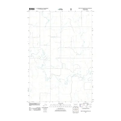
2011 Map of Pretty Rock Butte SE
USGS Topo · Published 2011About this map
Cedar Creek and Brushy Creek dominate this Sioux County landscape, where the meandering waterways carve through the western North Dakota terrain. The area is defined by its drainage patterns, with Turtle Creek and Alkali Creek feeding into the larger stream systems. A rigid grid of section line roads, including 91st St SW and 90th Ave SW, provides the primary infrastructure through this rural expanse. This 2011 survey captures a moment in the region's modern agricultural and range management history, documenting the exact placement of local access roads such as 95th St SW and 71st Ave SW as they cross the various creek beds and draws.
Find a feature on this map
14 named features on this map. Tap any name to fly to it.
Don’t see what you’re looking for? This feature index may not catch every label — zoom into the map to look around manually.
Map Details
Editions of this 2011 Pretty Rock Butte SE Map
This is the sole edition of this map. No revisions or reprints were ever made.
Other maps of this area

1953 · McIntosh
USGS Topo · 1:250,000

1954 · Bismarck
USGS Topo · 1:250,000

1958 · Bismarck
USGS Topo · 1:250,000

1958 · McIntosh
USGS Topo · 1:250,000

1972 · Wheeler Hills
USGS Topo · 1:24,000

1972 · Coffin Buttes
USGS Topo · 1:24,000

1972 · Pretty Rock Butte
USGS Topo · 1:24,000

1972 · Morristown
USGS Topo · 1:24,000

1972 · Pretty Rock Butte SE
USGS Topo · 1:24,000

1972 · Round Top
USGS Topo · 1:24,000
Featured Places
- Menz Township, Porcupine District
- Porcupine District, ND
- Grant County, ND
- Sioux County, ND
- United States