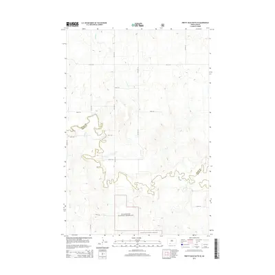
2014 Map of Pretty Rock Butte SE
USGS Topo · Published 2014About this map
Cedar River National Grassland dominates the southern reaches of this landscape, where the prairie transitions into the drainage basins of several local waterways. The serpentine path of Cedar Creek winds through the central portion of the quadrangle, joined by the smaller tributaries of Brushy Cr and Turtle Cr. The map illustrates a remote section of the Great Plains where the boundary between Grant Co and Sioux Co is defined by these natural watercourses. A sparse grid of section-line roads, including 91st St SW and 70th Ave SW, provides the only structural framework across the open terrain, highlighting the isolated nature of the ranching or conservation lands in this part of North Dakota. For the researcher, the map reveals the precise intersection of natural topography and the rectilinear property boundaries of the west, particularly where Alkali Cr meets the northern reaches of the sheet.
Find a feature on this map
17 named features on this map. Tap any name to fly to it.
Don’t see what you’re looking for? This feature index may not catch every label — zoom into the map to look around manually.
Map Details
Editions of this 2014 Pretty Rock Butte SE Map
This is the sole edition of this map. No revisions or reprints were ever made.
Other maps of this area

1953 · McIntosh
USGS Topo · 1:250,000

1954 · Bismarck
USGS Topo · 1:250,000

1958 · Bismarck
USGS Topo · 1:250,000

1958 · McIntosh
USGS Topo · 1:250,000

1972 · Wheeler Hills
USGS Topo · 1:24,000

1972 · Coffin Buttes
USGS Topo · 1:24,000

1972 · Pretty Rock Butte
USGS Topo · 1:24,000

1972 · Morristown
USGS Topo · 1:24,000

1972 · Pretty Rock Butte SE
USGS Topo · 1:24,000

1972 · Round Top
USGS Topo · 1:24,000
Featured Places
- Menz Township, Porcupine District
- Porcupine District, ND
- Grant County, ND
- Sioux County, ND
- United States