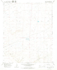
1966 Map of Pretty Rock
USGS Topo · Published 1979About this map
Pretty Rock anchors this high-desert landscape in the mid-1960s, a period captured through photogrammetric methods just before the region's infrastructure expanded. The map reveals a land defined by complex drainage systems and arid plateaus, where the vast Lip Flats overlook a network of seasonal watercourses. Significant topographic features like Tsaya Canyon and the winding De-na-zin Wash dominate the northern and southern reaches, illustrating the erosional character of the San Juan Basin. The presence of Black Lake provides a rare perennial water feature in this dry environment, while the path of Coal Creek suggests the underlying geological resources that have long influenced the development of this corner of New Mexico.
Find a feature on this map
7 named features on this map. Tap any name to fly to it.
Don’t see what you’re looking for? This feature index may not catch every label — zoom into the map to look around manually.
Map Details
Editions of this 1966 Pretty Rock Map
2 editions found
Other maps of this area

1889 · Largo
USGS Topo · 1:250,000

1889 · Chaco
USGS Topo · 1:250,000

1892 · Chaco
USGS Topo · 1:250,000

1895 · Largo
USGS Topo · 1:250,000

1954 · Shiprock
USGS Topo · 1:250,000

1954 · Aztec
USGS Topo · 1:250,000

1958 · Shiprock
USGS Topo · 1:250,000

1958 · Aztec
USGS Topo · 1:250,000

1959 · Shiprock
USGS Topo · 1:250,000

1962 · Aztec
USGS Topo · 1:250,000