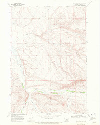
1968 Map of Price Creek NE
USGS Topo · Published 1972About this map
Andersen Ranch sits as the primary human landmark in this section of Beaverhead County, positioned where the drainage systems of the high country converge. The landscape is defined by the complex branching of Blacktail Deer Creek, which draws from the East Fork, Middle Fork, and West Fork. These waterways cut through the terrain, creating significant landmarks such as Red Canyon and its associated Red Canyon Creek. Smaller tributaries like Brock Creek, Rock Creek, and Alkali Creek further delineate the rugged topography.
Find a feature on this map
13 named features on this map. Tap any name to fly to it.
Don’t see what you’re looking for? This feature index may not catch every label — zoom into the map to look around manually.
Map Details
Editions of this 1968 Price Creek NE Map
2 editions found
Other maps of this area

1893 · Dillon
USGS Topo · 1:250,000

1955 · Dubois
USGS Topo · 1:250,000

1955 · Dillon
USGS Topo · 1:250,000

1957 · Dillon
USGS Topo · 1:250,000

1958 · Dubois
USGS Topo · 1:250,000

1958 · Dillon
USGS Topo · 1:250,000

1961 · Red Canyon
USGS Topo · 1:24,000

1961 · Elk Gulch
USGS Topo · 1:24,000

1962 · Dillon
USGS Topo · 1:250,000
1963 · Belmont Park Ranch
USGS Topo · 1:24,000