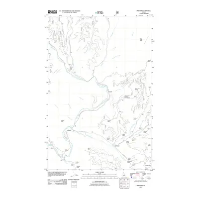
2011 Map of Prichard
USGS Topo · Published 2011About this map
The North Fork Coeur d'Alene River carves a deep path through Shoshone County, serving as the primary corridor for settlement and transit in this remote drainage. The 2011 landscape centers on the small communities of Prichard and Eagle, which are connected by Prichard Creek Rd. This area is defined by a dense network of gulches named for early prospectors and settlers, including George Gulch, Ucelly Gulch, and McComber Gulch, illustrating the region's long history of mineral exploration. High points such as Sparta Peak and Prichard Peak overlook the river valley, while recreational spots like Shoshone Forest Camp and Avery Creek Picnic Area mark the modern use of the forest lands. Researchers can trace the winding paths of Coeur d'Alene River Rd and various Forest Service routes like Nat For Dev Rd 208 as they follow the steep topography.
Find a feature on this map
64 named features on this map. Tap any name to fly to it.
Don’t see what you’re looking for? This feature index may not catch every label — zoom into the map to look around manually.
Map Details
Editions of this 2011 Prichard Map
This is the sole edition of this map. No revisions or reprints were ever made.
Other maps of this area

1901 · Coeur D'Alene District
USGS Topo · 1:62,500

1903 · Coeur D'Alene District
USGS Topo · 1:62,500

1906 · Coeur D'Alene District
USGS Topo · 1:62,500

1909 · Cataldo
USGS Topo · 1:125,000

1911 · Cataldo
USGS Topo · 1:125,000

1932 · Trout Creek
USGS Topo · 1:125,000

1935 · Trout Creek
USGS Topo · 1:125,000

1936 · Trout Creek
USGS Topo · 1:125,000

1955 · Spokane
USGS Topo · 1:250,000

1956 · Wallace
USGS Topo · 1:250,000