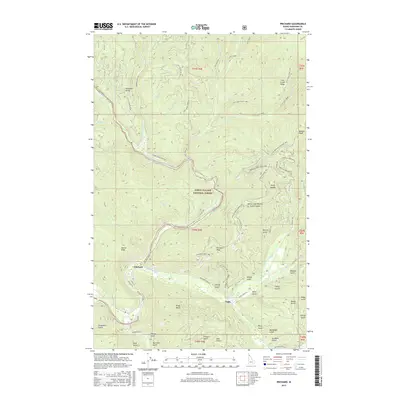
2017 Map of Prichard
USGS Topo · Published 2017About this map
Prichard and Eagle sit at the center of this mountain landscape, positioned along the winding North Fork Coeur d'Alene River and Prichard Creek. The map documents a terrain defined by deep gulches and steep ridges within the Coeur d'Alene National Forest. This 2017 survey reveals the extensive network of forest development roads, such as Nat For Dev Rd 208 and Prichard Creek Rd, that provide access to the high peaks of the Shoshone Range.
Find a feature on this map
78 named features on this map. Tap any name to fly to it.
Don’t see what you’re looking for? This feature index may not catch every label — zoom into the map to look around manually.
Map Details
Editions of this 2017 Prichard Map
This is the sole edition of this map. No revisions or reprints were ever made.
Other maps of this area

1901 · Coeur D'Alene District
USGS Topo · 1:62,500

1903 · Coeur D'Alene District
USGS Topo · 1:62,500

1906 · Coeur D'Alene District
USGS Topo · 1:62,500

1909 · Cataldo
USGS Topo · 1:125,000

1911 · Cataldo
USGS Topo · 1:125,000

1932 · Trout Creek
USGS Topo · 1:125,000

1935 · Trout Creek
USGS Topo · 1:125,000

1936 · Trout Creek
USGS Topo · 1:125,000

1955 · Spokane
USGS Topo · 1:250,000

1956 · Wallace
USGS Topo · 1:250,000