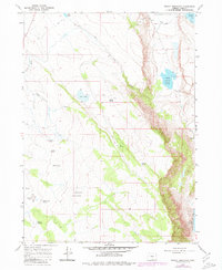
1967 Map of Priday Reservoir
USGS Topo · Published 1980About this map
Warner Valley forms the central character of this high-desert landscape, where the seasonal hydrology of south-central Oregon is documented in detail. The terrain is defined by a series of significant lakes and reservoirs, most notably Crump Lake and Hart Lake, which are part of the larger Warner Lakes system. The 1967 field data, updated with 1979 aerial photography, reveals a network of water sources vital for ranching, including the Priday Reservoir and its spillway, alongside the lone settlement at Barry Ranch.
Find a feature on this map
27 named features on this map. Tap any name to fly to it.
Don’t see what you’re looking for? This feature index may not catch every label — zoom into the map to look around manually.
Map Details
Editions of this 1967 Priday Reservoir Map
2 editions found
Other maps of this area

1955 · Klamath Falls
USGS Topo · 1:250,000

1955 · Adel
USGS Topo · 1:250,000

1957 · Adel
USGS Topo · 1:250,000

1958 · Klamath Falls
USGS Topo · 1:250,000

1958 · Adel
USGS Topo · 1:250,000

1962 · Adel
USGS Topo · 1:250,000

1967 · Plush
USGS Topo · 1:24,000

1967 · Priday Reservoir
USGS Topo · 1:24,000

1967 · Hart Lake
USGS Topo · 1:24,000

1967 · Crump Lake
USGS Topo · 1:24,000