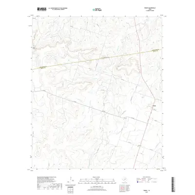
2019 Map of Priddy
USGS Topo · Published 2019About this map
The community of Priddy sits at the intersection of FM 218 and Schlee St in the northeastern corner of this Mills County landscape. This rural expanse is defined by the winding drainages of Mountain Creek and its tributaries, which carve through a series of prominent elevations. Significant landmarks like Taterhill Mtn and the topographical notch at Cedar Gap overlook a network of county roads that have long served the local agricultural economy. For genealogists, the map preserves the locations of Priddy Cem and Zion Cem, resting places that anchor the history of the families who settled this part of Central Texas. The boundary line separating Comanche Co and Mills Co bisects the northern half of the quadrangle, illustrating the political geography of the ranching country.
Find a feature on this map
31 named features on this map. Tap any name to fly to it.
Don’t see what you’re looking for? This feature index may not catch every label — zoom into the map to look around manually.
Map Details
Editions of this 2019 Priddy Map
This is the sole edition of this map. No revisions or reprints were ever made.
Other maps of this area

1888 · Hamilton
USGS Topo · 1:125,000

1889 · Brownwood
USGS Topo · 1:125,000

1894 · Hamilton
USGS Topo · 1:125,000

1894 · Brownwood
USGS Topo · 1:125,000

1925 · Brownwood 4-c
USGS Topo · 1:48,000

1931 · Mullin
USGS Topo · 1:62,500

1950 · Mullin
USGS Topo · 1:62,500

1954 · Brownwood
USGS Topo · 1:250,000

1956 · Gustine
USGS Topo · 1:62,500

1956 · Gustine
USGS Topo · 1:24,000