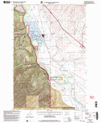
1999 Map of Primrose
USGS Topo · Published 2003About this map
The Clark Fork winds through a landscape defined by industrial development and early state heritage in the late 1990s. At Schilling, a large Paper Plant and nearby Substations sit alongside the Schilling Siding railroad spur, marking a center of local industry within the Grass Valley. Further south, the map highlights the Council Grove State Monument and the adjacent Council Grove park, preserving a significant historic site along the riverbanks.
Find a feature on this map
33 named features on this map. Tap any name to fly to it.
Don’t see what you’re looking for? This feature index may not catch every label — zoom into the map to look around manually.
Map Details
Editions of this 1999 Primrose Map
This is the sole edition of this map. No revisions or reprints were ever made.
Other maps of this area

1912 · Missoula
USGS Topo · 1:125,000

1956 · Wallace
USGS Topo · 1:250,000

1956 · Hamilton
USGS Topo · 1:250,000

1959 · Hamilton
USGS Topo · 1:250,000

1959 · Alberton
USGS Topo · 1:62,500

1959 · Arlee
USGS Topo · 1:62,500

1960 · Wallace
USGS Topo · 1:250,000

1960 · Hamilton
USGS Topo · 1:250,000

1963 · Primrose
USGS Topo · 1:24,000

1964 · Hamilton
USGS Topo · 1:250,000