Loading...
Loading map...2022 Map of Primrose
USGS Topo · Published 2022About this map
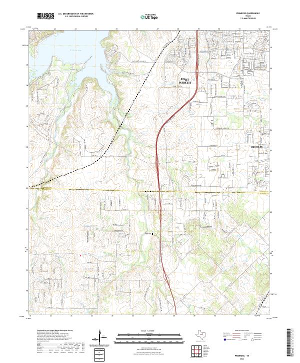
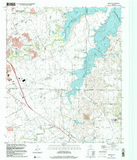
Fort Worth and Crowley anchors the landscape of this contemporary survey, illustrating the continuing suburban expansion south of the Metroplex. The Chisholm Trail Pkwy serves as a modern spinal cord for the region, cutting a path through the rolling terrain toward the Tarrant and Johnson county line. This corridor bridges the gap between high-density residential developments like Sunscape Ln and the more open ranch lands defined by Hencken Ranch Rd and Pearl Ranch Rd.
Find a feature on this map
70 named features on this map. Tap any name to fly to it.
Don’t see what you’re looking for? This feature index may not catch every label — zoom into the map to look around manually.
Map Details
Date Portrayed2022
Date Published2022
PublisherU.S. Geological Survey
Map TypeTopographic
Scale1:24000
Physical Dimensions24 x 29 inches
Editions of this 2022 Primrose Map
This is the sole edition of this map. No revisions or reprints were ever made.
Historical Maps of Fort Worth Through Time
7 maps found
Featured Locations
Source Details
SourceU.S. Geological Survey
CopyrightPublic Domain