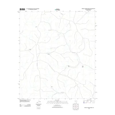
2012 Map of Prince Albert Draw
USGS Topo · Published 2012About this map
Prince Albert Draw snakes through this arid section of Crockett County, defining the drainage patterns of a landscape marked by ranching infrastructure and remote access roads. The prevalence of named water-pumping sites, such as the Henderson Windmill, Rockwall Windmill, and Sulfur Windmill, highlights the critical importance of groundwater management in this part of West Texas. These scattered landmarks serve as the primary navigational points across the terrain, connected by a sparse network of thoroughfares including Scott Canyon Rd and Hoover Divide Rd. The spatial distribution of these windmills suggests a legacy of partitioned grazing lands, where each named well site—from the Goat Windmill to the Prince Albert Windmill—supports livestock operations in a region where surface water is seasonal or non-existent.
Find a feature on this map
11 named features on this map. Tap any name to fly to it.
Don’t see what you’re looking for? This feature index may not catch every label — zoom into the map to look around manually.
Map Details
Editions of this 2012 Prince Albert Draw Map
This is the sole edition of this map. No revisions or reprints were ever made.
Other maps of this area

1929 · Sheffield
USGS Topo · 1:125,000

1954 · Sonora
USGS Topo · 1:250,000

1958 · Sonora
USGS Topo · 1:250,000

1967 · Burnt Canyon
USGS Topo · 1:24,000

1967 · Dead Man Canyon
USGS Topo · 1:24,000

1967 · Mitchell Canyon
USGS Topo · 1:24,000

1970 · Antone Canyon
USGS Topo · 1:24,000

1970 · Howards Well
USGS Topo · 1:24,000

1970 · Howards Well SW
USGS Topo · 1:24,000
1970 · Prince Albert Draw
USGS Topo · 1:24,000