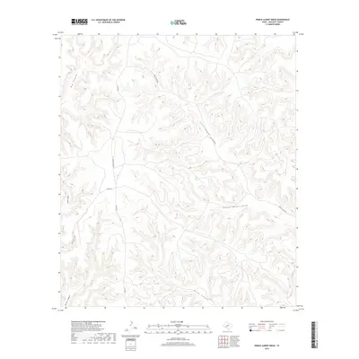
2019 Map of Prince Albert Draw
USGS Topo · Published 2019About this map
Prince Albert Draw cuts through the high desert plateau of Crockett County, defining a landscape of dramatic relief and deep drainage systems. This 2019 survey illustrates the specialized ranching infrastructure of West Texas, where isolated routes like Hoover Divide Rd and Scott Canyon Rd follow the natural contours of the land to connect remote outposts. The map reveals the intricate network of canyons that feed into larger draws, most notably Big Canyon in the northwest and Horse Canyon in the south.
Find a feature on this map
10 named features on this map. Tap any name to fly to it.
Don’t see what you’re looking for? This feature index may not catch every label — zoom into the map to look around manually.
Map Details
Editions of this 2019 Prince Albert Draw Map
This is the sole edition of this map. No revisions or reprints were ever made.
Other maps of this area

1929 · Sheffield
USGS Topo · 1:125,000

1954 · Sonora
USGS Topo · 1:250,000

1958 · Sonora
USGS Topo · 1:250,000

1967 · Burnt Canyon
USGS Topo · 1:24,000

1967 · Dead Man Canyon
USGS Topo · 1:24,000

1967 · Mitchell Canyon
USGS Topo · 1:24,000

1970 · Antone Canyon
USGS Topo · 1:24,000

1970 · Howards Well
USGS Topo · 1:24,000

1970 · Howards Well SW
USGS Topo · 1:24,000
1970 · Prince Albert Draw
USGS Topo · 1:24,000