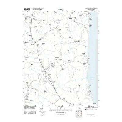
2011 Map of Prince Frederick
USGS Topo · Published 2011About this map
Prince Frederick Post Office serves as a central hub for this portion of Calvert County, where the landscape transitions from the developed corridor of MD 2 and MD 4 to the shoreline of the Chesapeake Bay. The map documents a dense network of residential communities and agricultural holdouts, such as Biglanes Choice and Lucky Cricket Farm, reflecting the region's evolving land use in the early 21st century. Along the coast, the famous Calvert Cliffs stand as a prominent geological feature, while maritime activity is centered at Breezy Point Marina. Local history is preserved in numerous burial grounds, including the Saint Pauls Cemetery and Trinity Cemetery, which provide vital touchstones for genealogical research. The drainage patterns of Hunting Creek and Parkers Creek further define the area's geography, winding through wooded tracts like Lord Cecil Woods and Parrans Woods.
Find a feature on this map
111 named features on this map. Tap any name to fly to it.
Don’t see what you’re looking for? This feature index may not catch every label — zoom into the map to look around manually.
Map Details
Editions of this 2011 Prince Frederick Map
This is the sole edition of this map. No revisions or reprints were ever made.
Other maps of this area

1892 · Leonardtown
USGS Topo · 1:62,500

1892 · Drum Point
USGS Topo · 1:62,500

1892 · Prince Frederick
USGS Topo · 1:62,500

1893 · Sharps Island
USGS Topo · 1:62,500

1895 · Prince Frederick
USGS Topo · 1:62,500

1895 · Leonardtown
USGS Topo · 1:62,500

1895 · Nomini
USGS Topo · 1:125,000

1898 · Choptank
USGS Topo · 1:125,000

1898 · Nomini
USGS Topo · 1:125,000

1898 · St. Marys
USGS Topo · 1:125,000