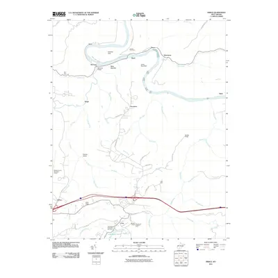
2011 Map of Prince
USGS Topo · Published 2011About this map
The New River carves a dramatic oxbow around Stretcher Neck in this West Virginia survey, revealing a landscape defined by deep hollows and high ridges. The community of Prince sits at the northern apex of this bend, while Quinnimont and Royal anchor the riverbanks nearby. Engineering feats are visible in the Stretcher Neck Tunnel, which bypasses the long river loop. Moving south away from the river, the terrain levels slightly near the Raleigh County Memorial Airport and the settlement of Crow. Local landmarks like the Round Knob Lookout Tower and Turkey Spur Rock provide vantage points over the surrounding drainage networks of Glade Creek and Piney River. To the southwest, Little Beaver State Park Lake Dam creates a significant recreation area centered on Little Beaver Lake.
Find a feature on this map
66 named features on this map. Tap any name to fly to it.
Don’t see what you’re looking for? This feature index may not catch every label — zoom into the map to look around manually.
Map Details
Editions of this 2011 Prince Map
This is the sole edition of this map. No revisions or reprints were ever made.
Other maps of this area

1887 · Hinton
USGS Topo · 1:125,000

1891 · Raleigh
USGS Topo · 1:125,000

1892 · Hinton
USGS Topo · 1:125,000

1897 · Raleigh
USGS Topo · 1:125,000

1902 · Raleigh
USGS Topo · 1:125,000

1911 · Flattop
USGS Topo · 1:48,000

1911 · Beckley
USGS Topo · 1:48,000

1912 · Meadow Creek
USGS Topo · 1:48,000

1912 · Big Bend
USGS Topo · 1:62,500

1913 · Beckley
USGS Topo · 1:62,500