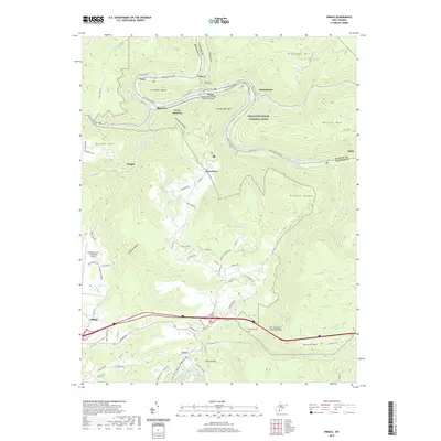
2019 Map of Prince
USGS Topo · Published 2019About this map
New River Gorge National River defines the central corridor of this survey, where the waterway makes a sharp oxbow around Stretcher Neck. This dramatic bend is pierced by the Stretcher Neck Tunnel, a vital piece of infrastructure facilitating rail transport through the steep river canyon. The settlements of Prince, Royal, and Quinnimont line the river banks, reflecting the historic reliance on the valley floor for transportation and industry.
Find a feature on this map
100 named features on this map. Tap any name to fly to it.
Don’t see what you’re looking for? This feature index may not catch every label — zoom into the map to look around manually.
Map Details
Editions of this 2019 Prince Map
This is the sole edition of this map. No revisions or reprints were ever made.
Other maps of this area

1887 · Hinton
USGS Topo · 1:125,000

1891 · Raleigh
USGS Topo · 1:125,000

1892 · Hinton
USGS Topo · 1:125,000

1897 · Raleigh
USGS Topo · 1:125,000

1902 · Raleigh
USGS Topo · 1:125,000

1911 · Flattop
USGS Topo · 1:48,000

1911 · Beckley
USGS Topo · 1:48,000

1912 · Meadow Creek
USGS Topo · 1:48,000

1912 · Big Bend
USGS Topo · 1:62,500

1913 · Beckley
USGS Topo · 1:62,500